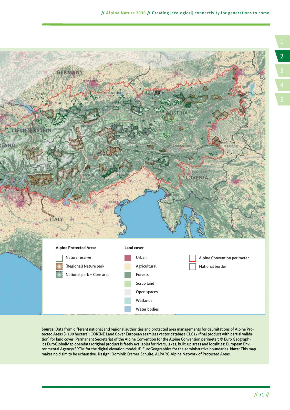
Nature reserve Regional Nature park National park Core area Alpine Protected Areas Land cover Urban Agricultural Forests Scrub land Open spaces Wetlands Water bodies Alpine Convention perimeter National border 1 4 2 5 3 71 Alpine Nature 2030 Creating ecological connectivity for generations to come Source Data from different national and regional authorities and protected area managements for delimitations of Alpine Pro tected Areas 100 hectare CORINE Land Cover European seamless vector database CLC12 final product with partial valida tion for land cover Permanent Secretariat of the Alpine Convention for the Alpine Convention perimeter Euro Geograph ics EuroGlobalMap opendata original product is freely available for rivers lakes built up areas and localities European Envi ronmental Agency SRTM for the digital elevation model EuroGeographics for the administrative boundaries Note This map makes no claim to be exhaustive Design Dominik Cremer Schulte ALPARC Alpine Network of Protected Areas Map 7 Land use and Alpine Protected Areas
Hinweis: Dies ist eine maschinenlesbare No-Flash Ansicht.
Klicken Sie hier um zur Online-Version zu gelangen.
Klicken Sie hier um zur Online-Version zu gelangen.