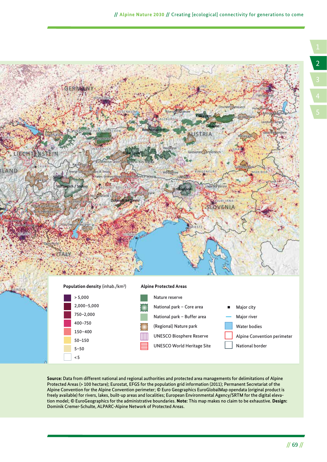
5 000 2 000 5 000 750 2 000 400 750 150 400 50 150 5 50 5 Population density inhab km2 Alpine Protected Areas Nature reserve National park Core area National park Buffer area Regional Nature park UNESCO Biosphere Reserve UNESCO World Heritage Site Major city Major river Water bodies Alpine Convention perimeter National border 1 4 2 5 3 69 Alpine Nature 2030 Creating ecological connectivity for generations to come Source Data from different national and regional authorities and protected area managements for delimitations of Alpine Protected Areas 100 hectare Eurostat EFGS for the population grid information 2011 Permanent Secretariat of the Alpine Convention for the Alpine Convention perimeter Euro Geographics EuroGlobalMap opendata original product is freely available for rivers lakes built up areas and localities European Environmental Agency SRTM for the digital eleva tion model EuroGeographics for the administrative boundaries Note This map makes no claim to be exhaustive Design Dominik Cremer Schulte ALPARC Alpine Network of Protected Areas
Hinweis: Dies ist eine maschinenlesbare No-Flash Ansicht.
Klicken Sie hier um zur Online-Version zu gelangen.
Klicken Sie hier um zur Online-Version zu gelangen.