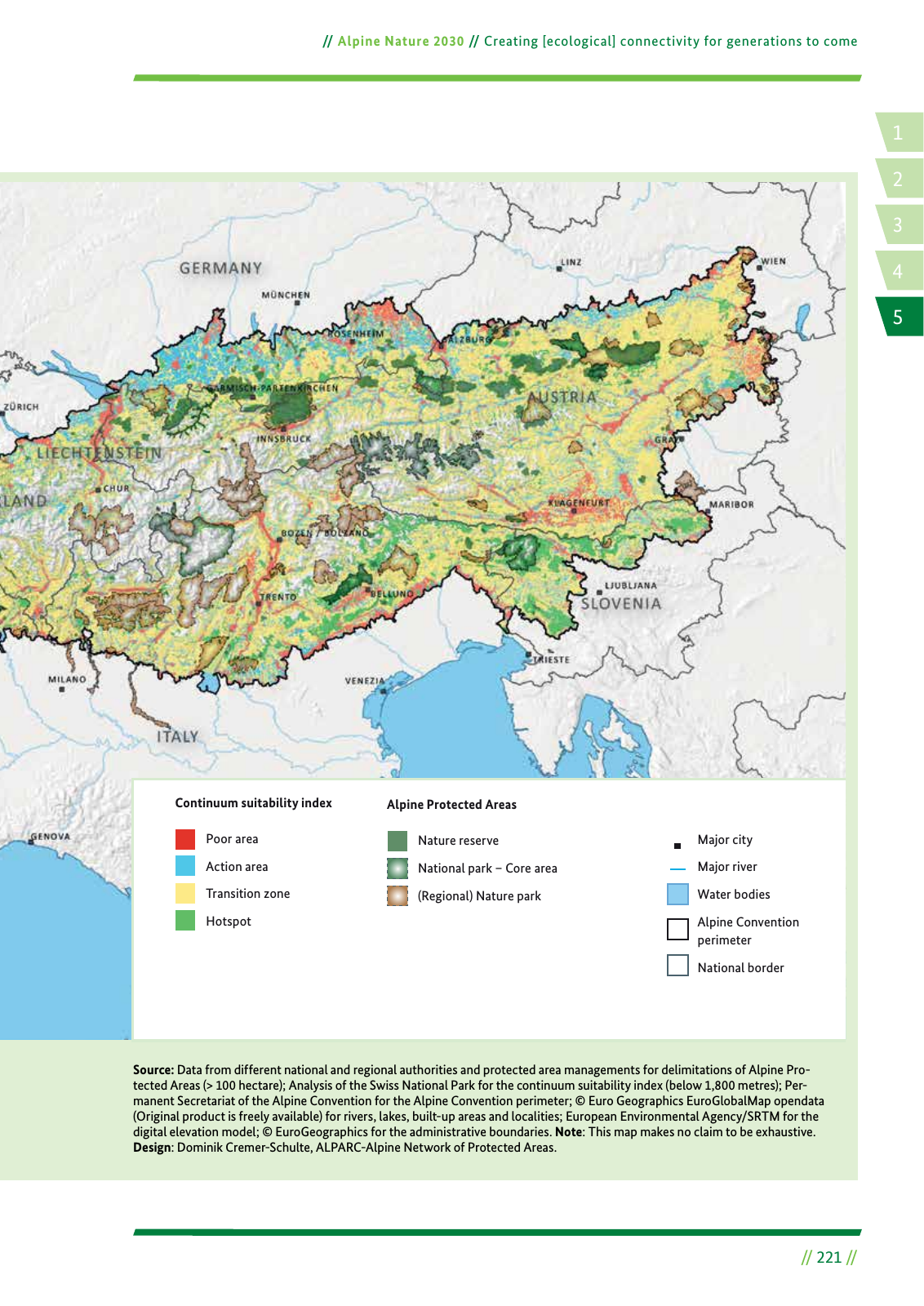
14 2 5 3 Alpine Nature 2030 Creating ecological connectivity for generations to come 221 Source Data from different national and regional authorities and protected area managements for delimitations of Alpine Pro tected Areas 100 hectare Analysis of the Swiss National Park for the continuum suitability index below 1 800 metres Per manent Secretariat of the Alpine Convention for the Alpine Convention perimeter Euro Geographics EuroGlobalMap opendata Original product is freely available for rivers lakes built up areas and localities European Environmental Agency SRTM for the digital elevation model EuroGeographics for the administrative boundaries Note This map makes no claim to be exhaustive Design Dominik Cremer Schulte ALPARC Alpine Network of Protected Areas Alpine Protected AreasContinuum suitability index Poor area Action area Transition zone Hotspot Major city Major river Water bodies Alpine Convention perimeter National border Nature reserve National park Core area Regional Nature park
Hinweis: Dies ist eine maschinenlesbare No-Flash Ansicht.
Klicken Sie hier um zur Online-Version zu gelangen.
Klicken Sie hier um zur Online-Version zu gelangen.