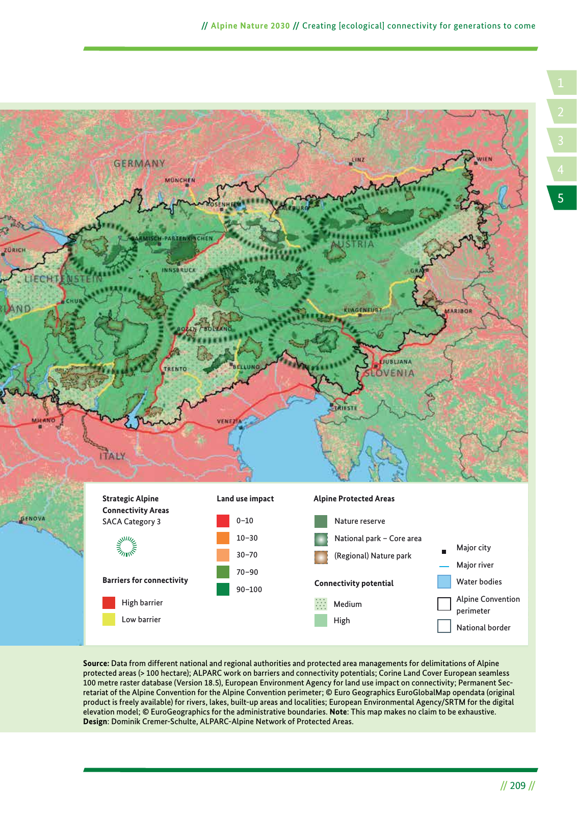
14 2 5 3 Alpine Nature 2030 Creating ecological connectivity for generations to come 209 Source Data from different national and regional authorities and protected area managements for delimitations of Alpine protected areas 100 hectare ALPARC work on barriers and connectivity potentials Corine Land Cover European seamless 100 metre raster database Version 18 5 European Environment Agency for land use impact on connectivity Permanent Sec retariat of the Alpine Convention for the Alpine Convention perimeter Euro Geographics EuroGlobalMap opendata original product is freely available for rivers lakes built up areas and localities European Environmental Agency SRTM for the digital elevation model EuroGeographics for the administrative boundaries Note This map makes no claim to be exhaustive Design Dominik Cremer Schulte ALPARC Alpine Network of Protected Areas Alpine Protected Areas Barriers for connectivity High barrier Low barrier Major city Major river Water bodies Alpine Convention perimeter National border Connectivity potential High Medium Nature reserve National park Core area Regional Nature park Land use impact 0 10 10 30 30 70 70 90 90 100 Strategic Alpine Connectivity Areas SACA Category 3
Hinweis: Dies ist eine maschinenlesbare No-Flash Ansicht.
Klicken Sie hier um zur Online-Version zu gelangen.
Klicken Sie hier um zur Online-Version zu gelangen.