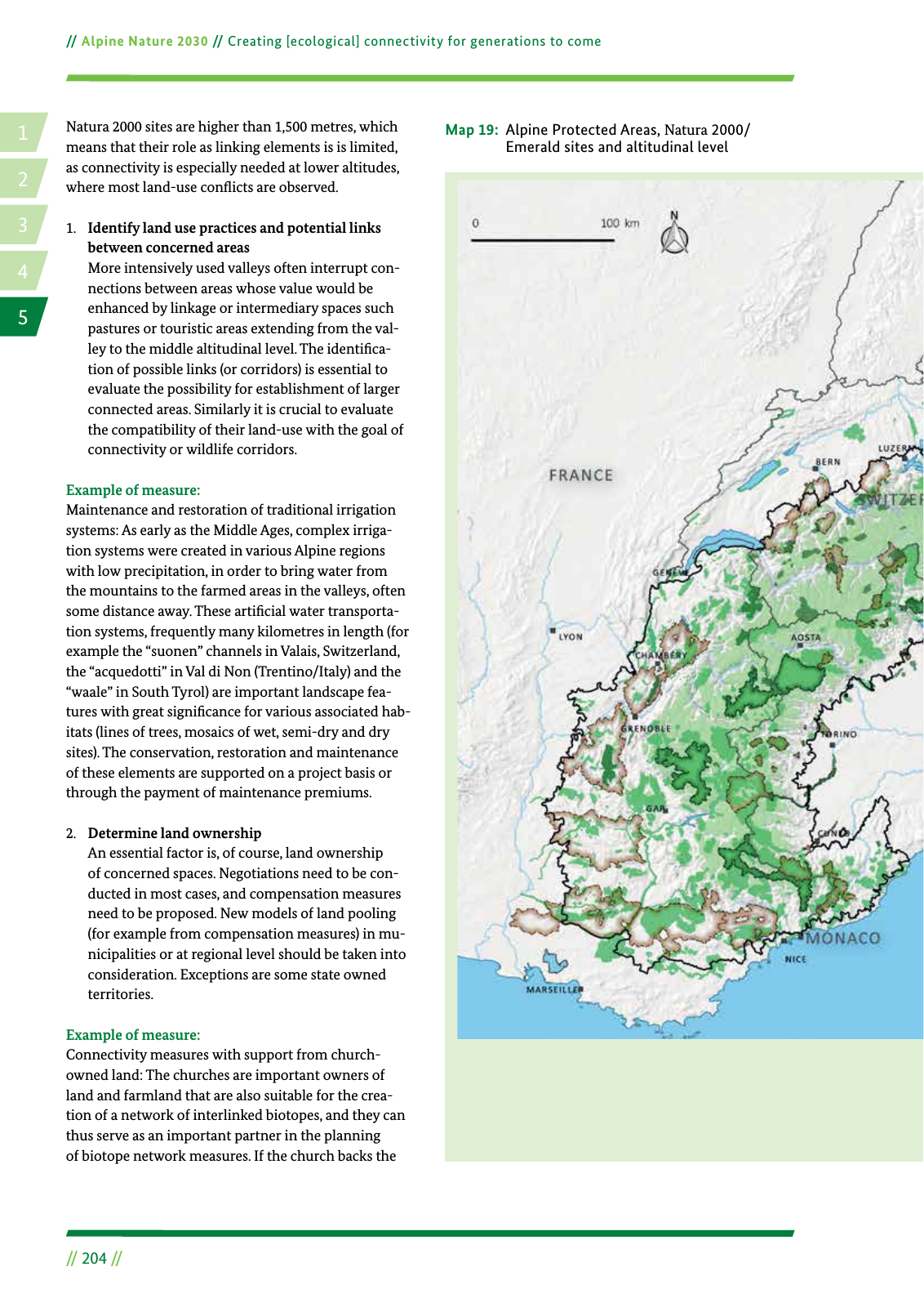
14 2 5 3 Alpine Nature 2030 Creating ecological connectivity for generations to come 204 Natura 2000 sites are higher than 1 500 metres which means that their role as linking elements is is limited as connectivity is especially needed at lower altitudes where most land use con icts are observed 1 Identify land use practices and potential links between concerned areas More intensively used valleys often interrupt con nections between areas whose value would be enhanced by linkage or intermediary spaces such pastures or touristic areas extending from the val ley to the middle altitudinal level The identi ca tion of possible links or corridors is essential to evaluate the possibility for establishment of larger connected areas Similarly it is crucial to evaluate the compatibility of their land use with the goal of connectivity or wildlife corridors Example of measure Maintenance and restoration of traditional irrigation systems As early as the Middle Ages complex irriga tion systems were created in various Alpine regions with low precipitation in order to bring water from the mountains to the farmed areas in the valleys often some distance away These arti cial water transporta tion systems frequently many kilometres in length for example the suonen channels in Valais Switzerland the acquedotti in Val di Non Trentino Italy and the waale in South Tyrol are important landscape fea tures with great signi cance for various associated hab itats lines of trees mosaics of wet semi dry and dry sites The conservation restoration and maintenance of these elements are supported on a project basis or through the payment of maintenance premiums 2 Determine land ownership An essential factor is of course land ownership of concerned spaces Negotiations need to be con ducted in most cases and compensation measures need to be proposed New models of land pooling for example from compensation measures in mu nicipalities or at regional level should be taken into consideration Exceptions are some state owned territories Example of measure Connectivity measures with support from church owned land The churches are important owners of land and farmland that are also suitable for the crea tion of a network of interlinked biotopes and they can thus serve as an important partner in the planning of biotope network measures If the church backs the Map 19 Alpine Protected Areas Natura 2000 Emerald sites and altitudinal level Alpine Protected Areas Major city Major river Water bodies Alpine Convention perimeter National border Nature reserve National park Core area Regional Nature park Natura 2000 areas and Emerald sites Areas above 1 500 metres

Hinweis: Dies ist eine maschinenlesbare No-Flash Ansicht.
Klicken Sie hier um zur Online-Version zu gelangen.
Klicken Sie hier um zur Online-Version zu gelangen.