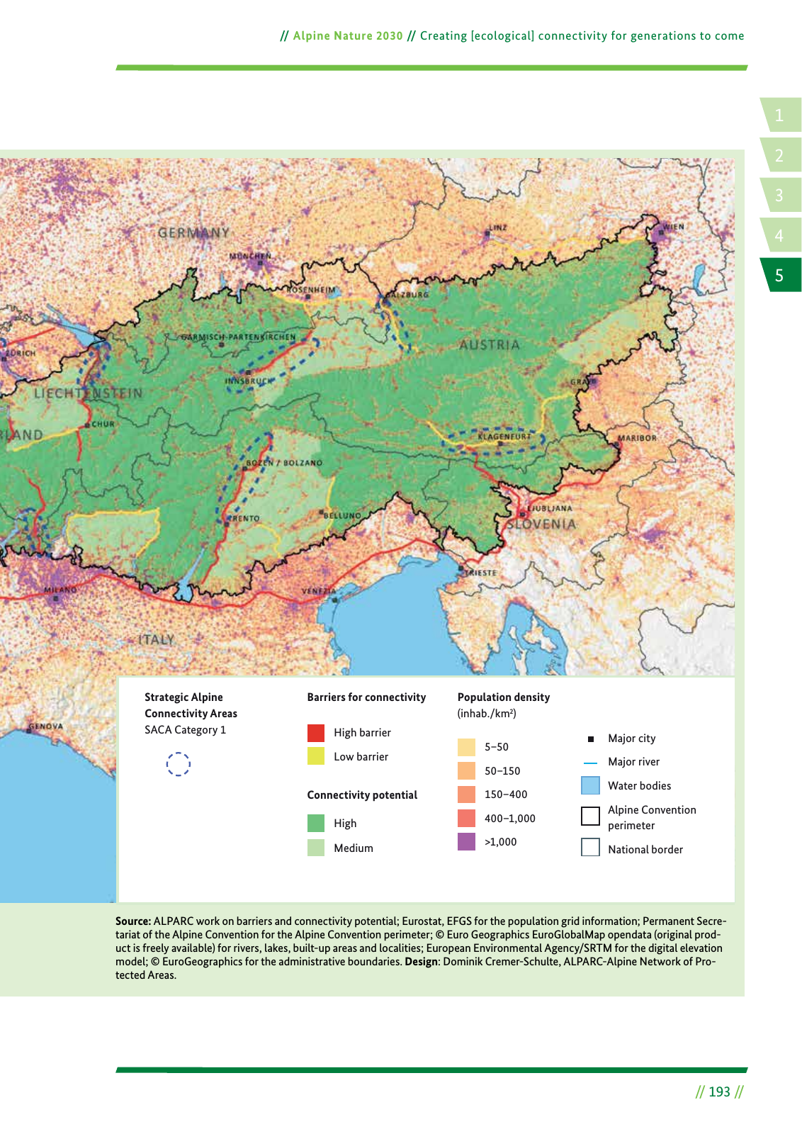
14 2 5 3 Alpine Nature 2030 Creating ecological connectivity for generations to come 193 Source ALPARC work on barriers and connectivity potential Eurostat EFGS for the population grid information Permanent Secre tariat of the Alpine Convention for the Alpine Convention perimeter Euro Geographics EuroGlobalMap opendata original prod uct is freely available for rivers lakes built up areas and localities European Environmental Agency SRTM for the digital elevation model EuroGeographics for the administrative boundaries Design Dominik Cremer Schulte ALPARC Alpine Network of Pro tected Areas Population density inhab km2 Barriers for connectivity Connectivity potential High barrier Low barrier High Medium 5 50 50 150 150 400 400 1 000 1 000 Major city Major river Water bodies Alpine Convention perimeter National border Strategic Alpine Connectivity Areas SACA Category 1
Hinweis: Dies ist eine maschinenlesbare No-Flash Ansicht.
Klicken Sie hier um zur Online-Version zu gelangen.
Klicken Sie hier um zur Online-Version zu gelangen.