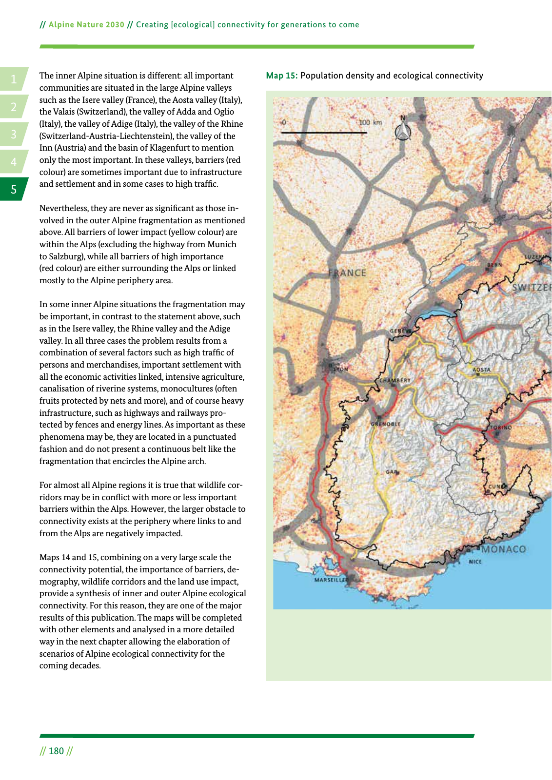
14 2 5 3 Alpine Nature 2030 Creating ecological connectivity for generations to come 180 The inner Alpine situation is different all important communities are situated in the large Alpine valleys such as the Isere valley France the Aosta valley Italy the Valais Switzerland the valley of Adda and Oglio Italy the valley of Adige Italy the valley of the Rhine Switzerland Austria Liechtenstein the valley of the Inn Austria and the basin of Klagenfurt to mention only the most important In these valleys barriers red colour are sometimes important due to infrastructure and settlement and in some cases to high traf c Nevertheless they are never as signi cant as those in volved in the outer Alpine fragmentation as mentioned above All barriers of lower impact yellow colour are within the Alps excluding the highway from Munich to Salzburg while all barriers of high importance red colour are either surrounding the Alps or linked mostly to the Alpine periphery area In some inner Alpine situations the fragmentation may be important in contrast to the statement above such as in the Isere valley the Rhine valley and the Adige valley In all three cases the problem results from a combination of several factors such as high traf c of persons and merchandises important settlement with all the economic activities linked intensive agriculture canalisation of riverine systems monocultures often fruits protected by nets and more and of course heavy infrastructure such as highways and railways pro tected by fences and energy lines As important as these phenomena may be they are located in a punctuated fashion and do not present a continuous belt like the fragmentation that encircles the Alpine arch For almost all Alpine regions it is true that wildlife cor ridors may be in con ict with more or less important barriers within the Alps However the larger obstacle to connectivity exists at the periphery where links to and from the Alps are negatively impacted Maps 14 and 15 combining on a very large scale the connectivity potential the importance of barriers de mography wildlife corridors and the land use impact provide a synthesis of inner and outer Alpine ecological connectivity For this reason they are one of the major results of this publication The maps will be completed with other elements and analysed in a more detailed way in the next chapter allowing the elaboration of scenarios of Alpine ecological connectivity for the coming decades Map 15 Population density and ecological connectivity Population density inhab km2 Barriers for connectivity Motorway traf c Line width traf c volume 5 50 50 150 150 400 400 1 000 1 000 Major city Major river Water bodies Alpine Convention perimeter National border High barrier Low barrier Built up area

Hinweis: Dies ist eine maschinenlesbare No-Flash Ansicht.
Klicken Sie hier um zur Online-Version zu gelangen.
Klicken Sie hier um zur Online-Version zu gelangen.