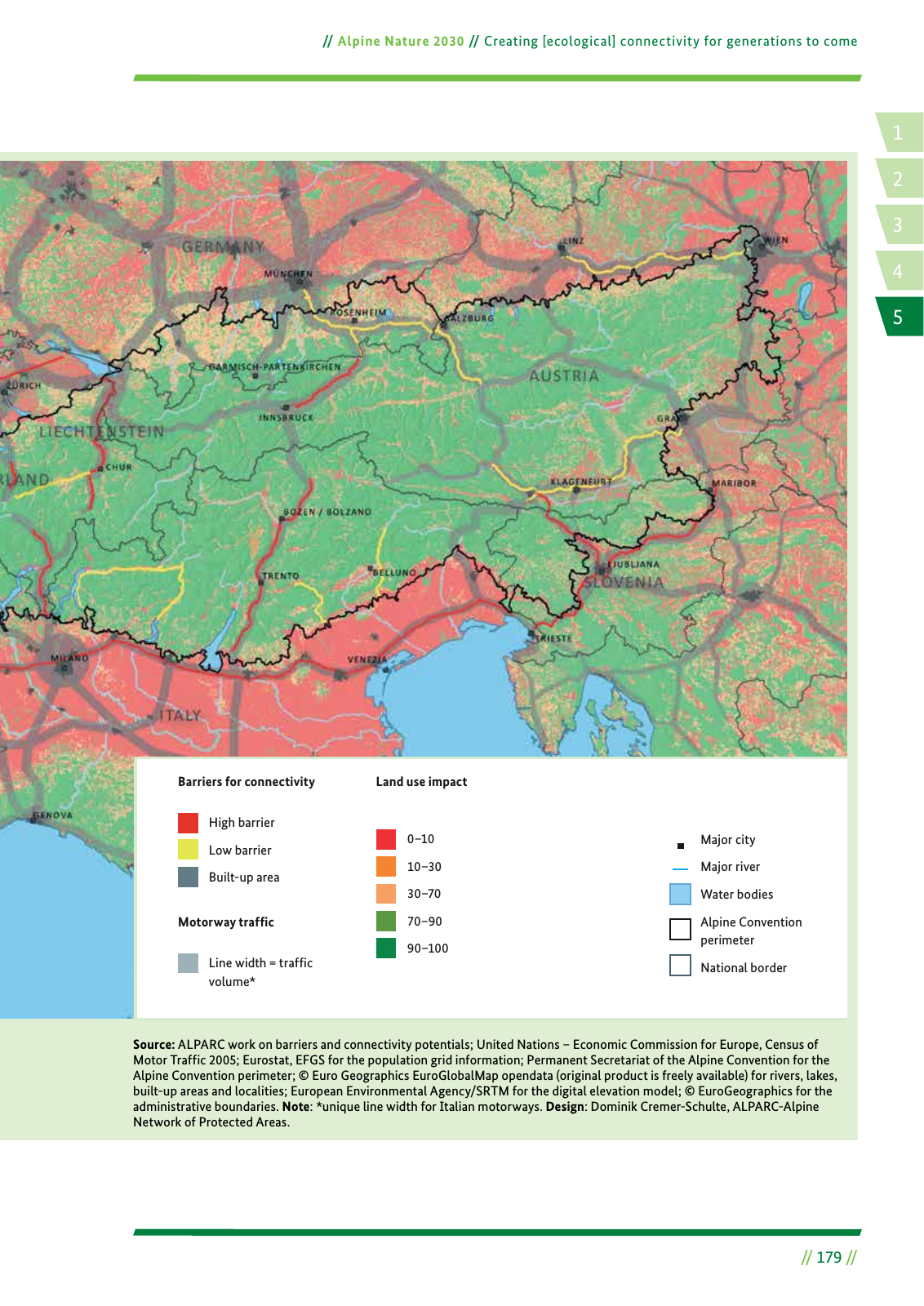
14 2 5 3 Alpine Nature 2030 Creating ecological connectivity for generations to come 179 Map 14 Land use and ecological connectivity Source ALPARC work on barriers and connectivity potentials United Nations Economic Commission for Europe Census of Motor Traffic 2005 Eurostat EFGS for the population grid information Permanent Secretariat of the Alpine Convention for the Alpine Convention perimeter Euro Geographics EuroGlobalMap opendata original product is freely available for rivers lakes built up areas and localities European Environmental Agency SRTM for the digital elevation model EuroGeographics for the administrative boundaries Note unique line width for Italian motorways Design Dominik Cremer Schulte ALPARC Alpine Network of Protected Areas Land use impactBarriers for connectivity Motorway traf c High barrier Low barrier Built up area Line width traf c volume 0 10 10 30 30 70 70 90 90 100 Major city Major river Water bodies Alpine Convention perimeter National border
Hinweis: Dies ist eine maschinenlesbare No-Flash Ansicht.
Klicken Sie hier um zur Online-Version zu gelangen.
Klicken Sie hier um zur Online-Version zu gelangen.