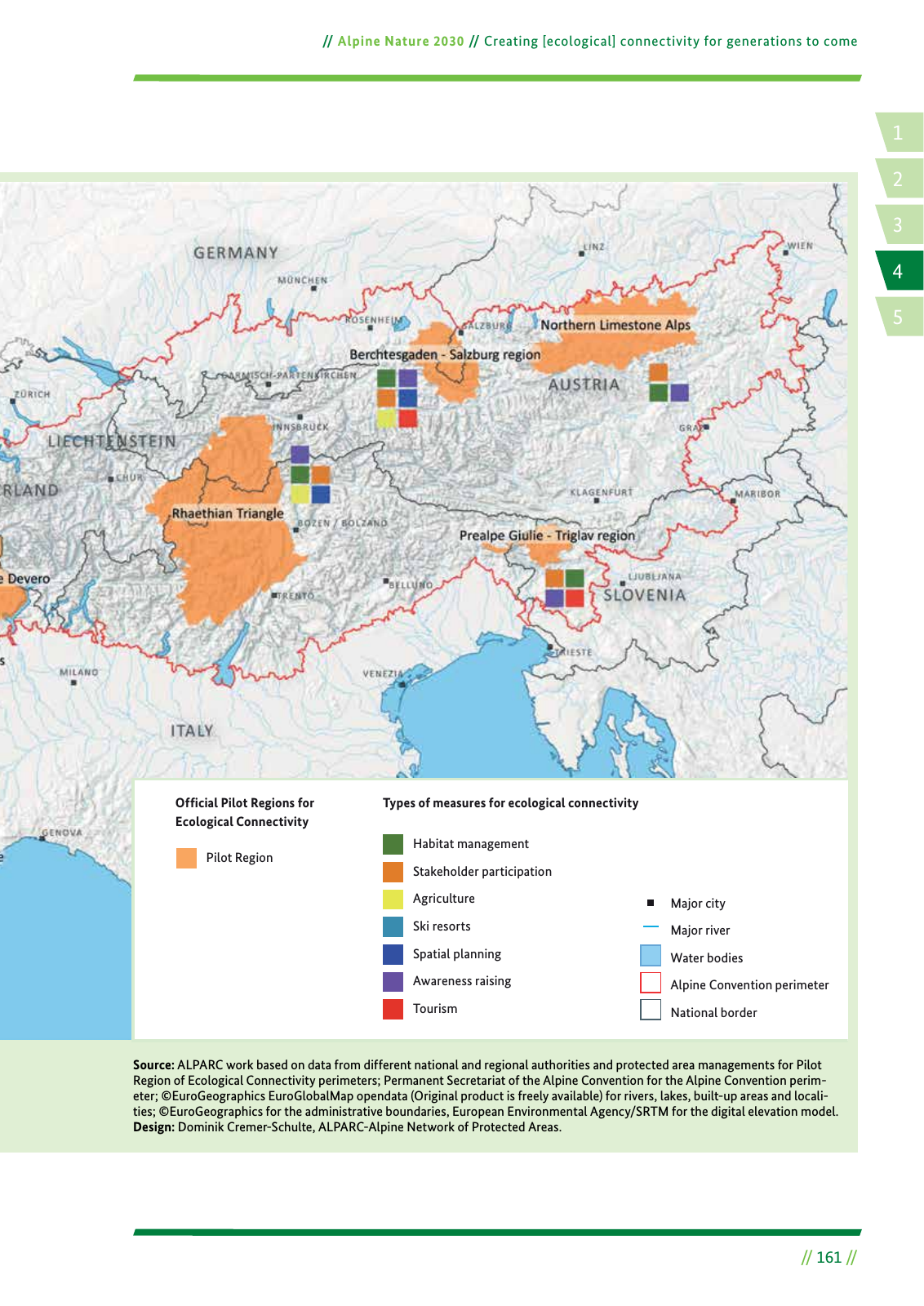
14 2 5 3 Alpine Nature 2030 Creating ecological connectivity for generations to come 161 Source ALPARC work based on data from different national and regional authorities and protected area managements for Pilot Region of Ecological Connectivity perimeters Permanent Secretariat of the Alpine Convention for the Alpine Convention perim eter EuroGeographics EuroGlobalMap opendata Original product is freely available for rivers lakes built up areas and locali ties EuroGeographics for the administrative boundaries European Environmental Agency SRTM for the digital elevation model Design Dominik Cremer Schulte ALPARC Alpine Network of Protected Areas Types of measures for ecological connectivity Habitat management Stakeholder participation Agriculture Ski resorts Spatial planning Awareness raising Tourism Major city Major river Water bodies Alpine Convention perimeter National border Ofªcial Pilot Regions for Ecological Connectivity Pilot Region
Hinweis: Dies ist eine maschinenlesbare No-Flash Ansicht.
Klicken Sie hier um zur Online-Version zu gelangen.
Klicken Sie hier um zur Online-Version zu gelangen.