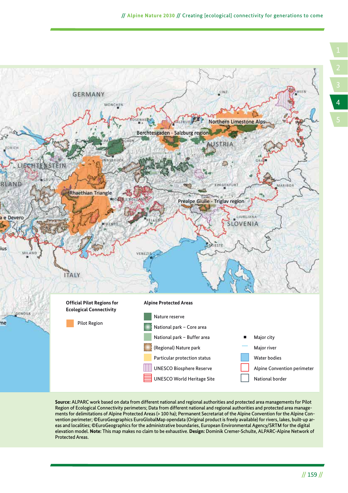
14 2 5 3 Alpine Nature 2030 Creating ecological connectivity for generations to come 159 Source ALPARC work based on data from different national and regional authorities and protected area managements for Pilot Region of Ecological Connectivity perimeters Data from different national and regional authorities and protected area manage ments for delimitations of Alpine Protected Areas 100 ha Permanent Secretariat of the Alpine Convention for the Alpine Con vention perimeter EuroGeographics EuroGlobalMap opendata Original product is freely available for rivers lakes built up ar eas and localities EuroGeographics for the administrative boundaries European Environmental Agency SRTM for the digital elevation model Note This map makes no claim to be exhaustive Design Dominik Cremer Schulte ALPARC Alpine Network of Protected Areas Major city Major river Water bodies Alpine Convention perimeter National border Nature reserve National park Core area National park Buffer area Regional Nature park Particular protection status UNESCO Biosphere Reserve UNESCO World Heritage Site Alpine Protected AreasOfªcial Pilot Regions for Ecological Connectivity Pilot Region
Hinweis: Dies ist eine maschinenlesbare No-Flash Ansicht.
Klicken Sie hier um zur Online-Version zu gelangen.
Klicken Sie hier um zur Online-Version zu gelangen.