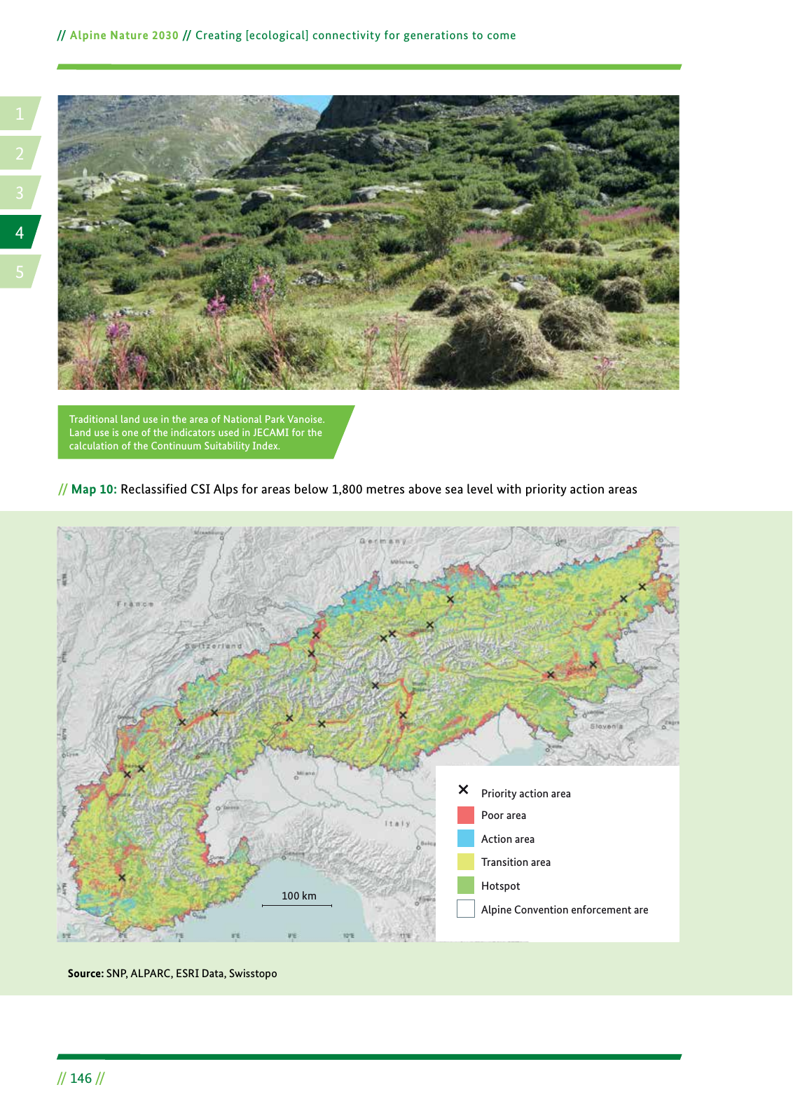
14 2 5 3 Alpine Nature 2030 Creating ecological connectivity for generations to come 146 Map 10 Reclassified CSI Alps for areas below 1 800 metres above sea level with priority action areas Source SNP ALPARC ESRI Data Swisstopo Traditional land use in the area of National Park Vanoise Land use is one of the indicators used in JECAMI for the calculation of the Continuum Suitability Index Poor area Action area Transition area Hotspot Alpine Convention enforcement are Priority action area 100 km
Hinweis: Dies ist eine maschinenlesbare No-Flash Ansicht.
Klicken Sie hier um zur Online-Version zu gelangen.
Klicken Sie hier um zur Online-Version zu gelangen.