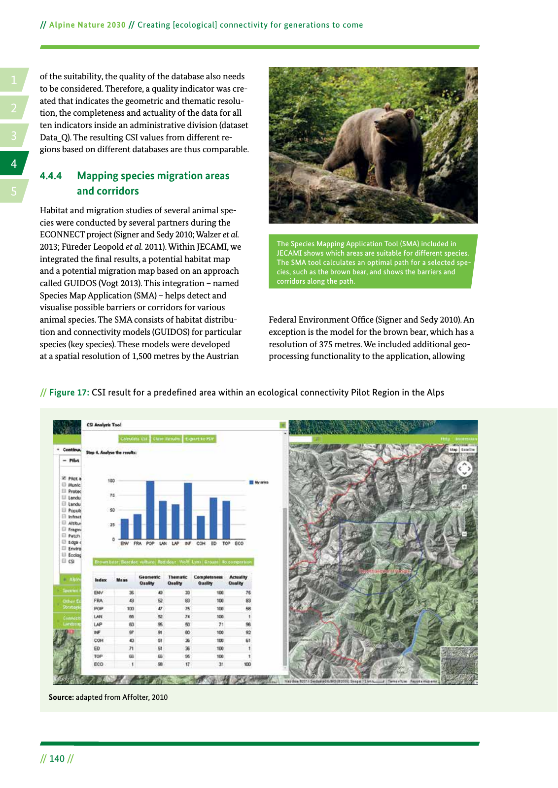
14 2 5 3 Alpine Nature 2030 Creating ecological connectivity for generations to come 140 Figure 17 CSI result for a predefined area within an ecological connectivity Pilot Region in the Alps Source adapted from Affolter 2010 of the suitability the quality of the database also needs to be considered Therefore a quality indicator was cre ated that indicates the geometric and thematic resolu tion the completeness and actuality of the data for all ten indicators inside an administrative division dataset Data Q The resulting CSI values from different re gions based on different databases are thus comparable 4 4 4 Mapping species migration areas and corridors Habitat and migration studies of several animal spe cies were conducted by several partners during the ECONNECT project Signer and Sedy 2010 Walzer et al 2013 Füreder Leopold et al 2011 Within JECAMI we integrated the nal results a potential habitat map and a potential migration map based on an approach called GUIDOS Vogt 2013 This integration named Species Map Application SMA helps detect and visualise possible barriers or corridors for various animal species The SMA consists of habitat distribu tion and connectivity models GUIDOS for particular species key species These models were developed at a spatial resolution of 1 500 metres by the Austrian Federal Environment Of ce Signer and Sedy 2010 An exception is the model for the brown bear which has a resolution of 375 metres We included additional geo processing functionality to the application allowing The Species Mapping Application Tool SMA included in JECAMI shows which areas are suitable for different species The SMA tool calculates an optimal path for a selected spe cies such as the brown bear and shows the barriers and corridors along the path
Hinweis: Dies ist eine maschinenlesbare No-Flash Ansicht.
Klicken Sie hier um zur Online-Version zu gelangen.
Klicken Sie hier um zur Online-Version zu gelangen.